

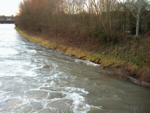
When the Jubilee River was first constructed in the late 1900’s the banks downstream of the Taplow Flow Control Structure were remodelled. The western bank (backing on to the old gasworks site) was laid to a shallow slope and then planted with trees.
The image below (dated 2014) records turbulent flow, bank erosion, the established trees and the gasworks in the background. The Berry Hill timber footbridge can be seen in the distance.
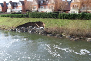
Ten years later (2024) and the gasworks site has been re-developed for housing. All the trees have been cleared along the entire bank so somebody can have a nice view. It can be seen that the toe of the embankment has received some (albeit insufficient) protection from erosion and the bank has been seriously scoured.
A helicopter had been used to place bags of stone into the cavity.
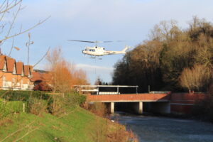
There is a 15 second video of the helicopter in action MVI_7126
END