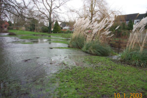
During the 2003 flood event the water surged out of the Thames, across the fields, into the Wraysbury Drain and then on upstream to surcharge the gravel pit.
Dated 10-1-2003 this image records post-peak flood water flows returning from the gravel pit and into the Wraysbury Drain (behind the Station Road/Douglas Lane houses).
The water is flowing from the pit on the left to the right and it is apparent that the Wraysbury Drain on the right is flowing at a lower level than the gravel pit. It should be noted that this arrangement only applied for a few days until the level of the pit dropped to the height of the embankment – then the flood water was trapped.

